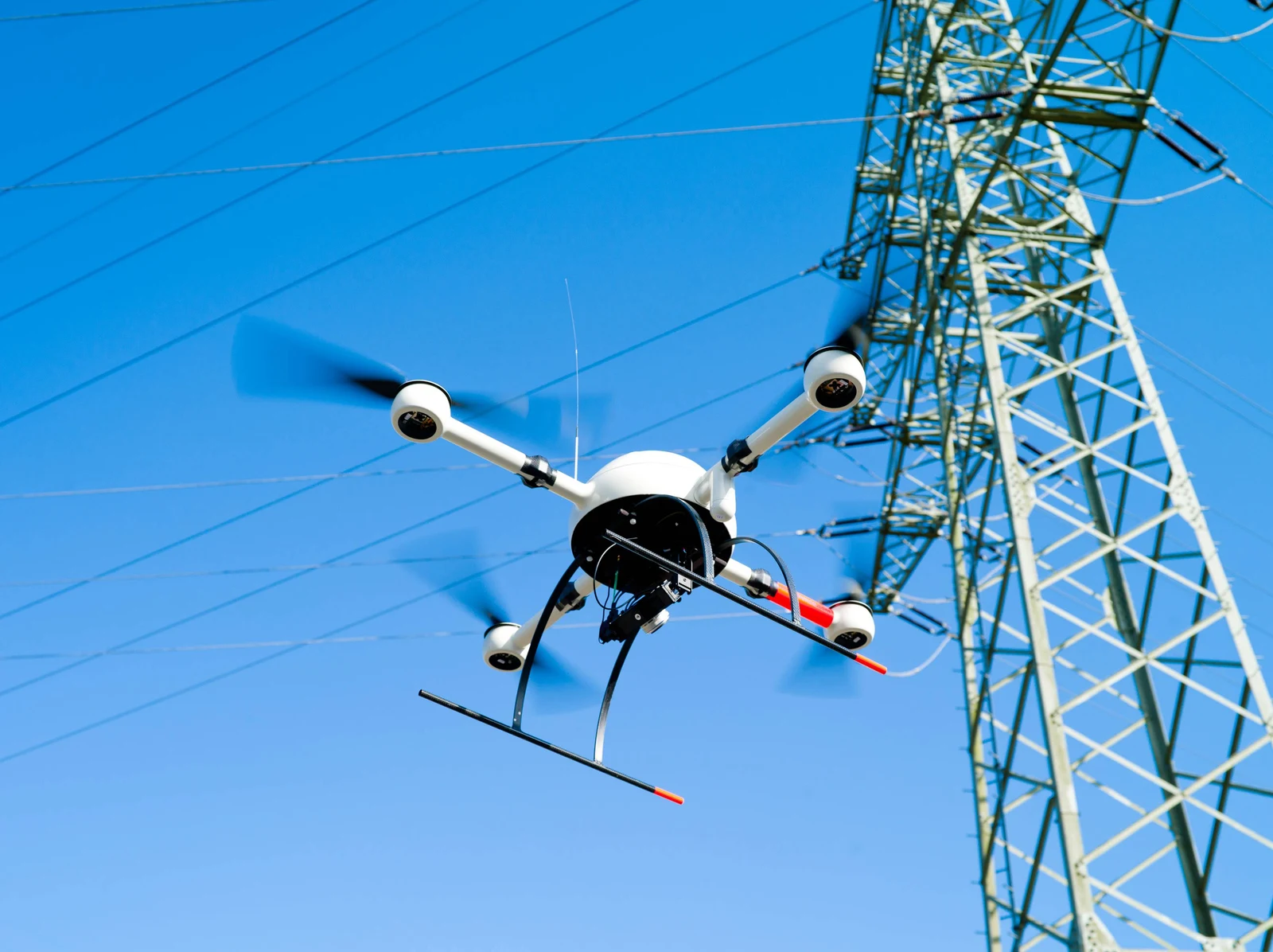
Power transmission networks stretch across mountains, forests, valleys, and densely developed areas. Inspecting these networks requires utility operators to monitor conductors, insulators, transmission towers, connectors, and surrounding vegetation—often in locations that are difficult or hazardous to access.
Traditional power line inspections rely on ground crews, climbing teams, and sometimes helicopters. Although these methods remain important, they can involve significant labor, access challenges, and operational costs.
Power line inspection drones offer a flexible alternative for collecting visual, thermal, and mapping data across electrical infrastructure.
Equipped with high-resolution cameras, zoom lenses, thermal imaging sensors, and intelligent flight systems, professional UAVs can support both close-range tower inspections and long-distance utility corridor surveys.
This guide explains how drone power line inspection works, which sensors are commonly used, how different UAV platforms compare, and what utility companies and equipment buyers should consider before selecting an inspection drone.
1. What Is Drone Power Line Inspection?
Drone power line inspection is the use of unmanned aerial vehicles (UAVs) to collect condition-monitoring data from electrical transmission and distribution infrastructure.
Depending on the aircraft and payload configuration, inspection drones can collect:
- High-resolution images of transmission towers and conductors
- Zoom-camera footage of insulators and electrical fittings
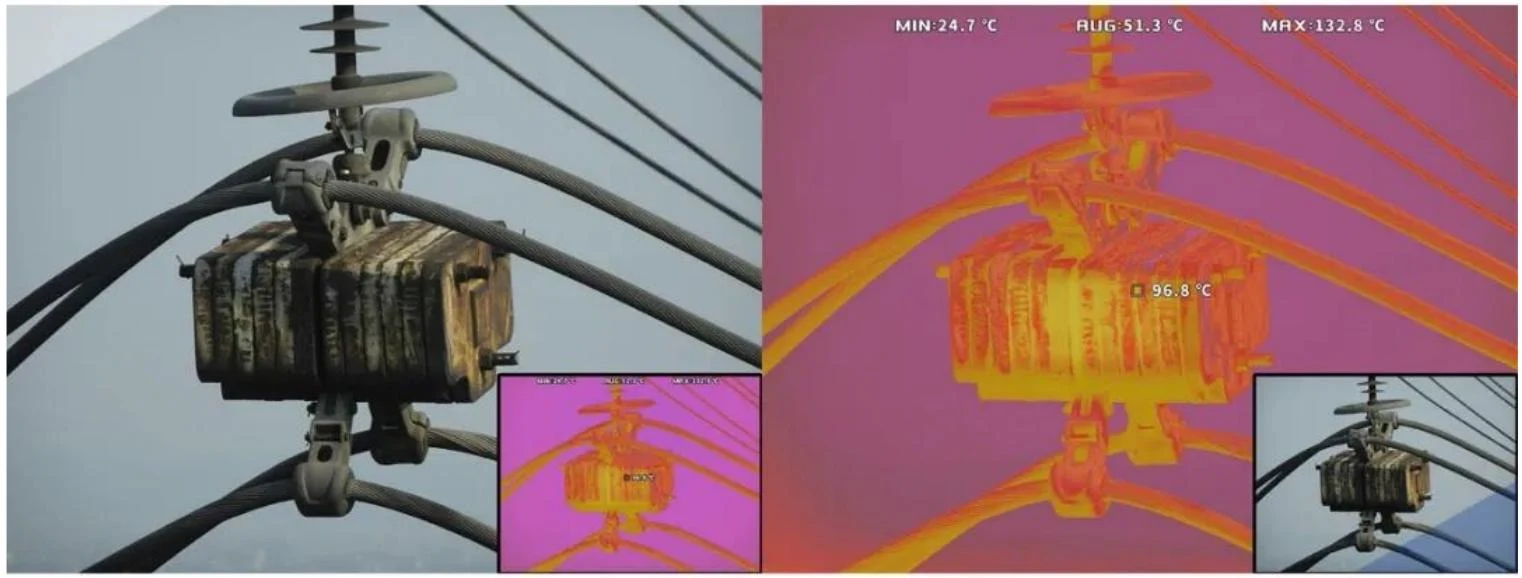
- Thermal images of selected electrical components
- Aerial maps of transmission corridors
- Visual records of vegetation near utility infrastructure
- Georeferenced imagery for maintenance planning
Instead of requiring technicians to access every inspection point physically, UAVs allow operators to observe infrastructure from suitable distances.
However, aerial inspection does not eliminate the need for qualified engineering assessments. Any suspected defect must be evaluated using the appropriate inspection standards and verification procedures.
2. Why Are Drones Used for Power Line Inspection?
Improve Access to Remote Infrastructure
Transmission lines frequently cross mountainous terrain, forests, rivers, and other areas where ground access is difficult.
Inspection drones can collect aerial imagery of selected infrastructure without requiring technicians to approach every tower or conductor.
This is particularly valuable for preliminary condition assessments and inspections of difficult-to-reach locations.
Support Safer Inspection Workflows
Electrical infrastructure presents risks related to energized components, height, terrain, and environmental conditions.
UAV inspections can reduce the need for some climbing and close-access activities by collecting data remotely.
Nevertheless, drones operating near power lines require appropriate electrical clearances, aviation permissions, risk assessments, and emergency procedures.
Improve Inspection Coverage
A well-planned UAV mission can collect imagery across multiple towers or sections of a transmission corridor.
Automated waypoints and repeatable flight routes can also support consistent inspection records.
For long-distance transmission networks, aircraft endurance and coverage efficiency become important factors in determining the appropriate inspection platform.
Support Preventive Maintenance
Visible damage, vegetation encroachment, abnormal temperature patterns, and structural concerns can be documented for further investigation.
Repeated inspections can help maintenance teams compare asset conditions over time and prioritize follow-up work.
3. What Can a Power Line Inspection Drone Detect?
The inspection capability of a UAV depends heavily on its camera and sensor configuration.
| Inspection Target | Potential Findings | Recommended Sensor |
|---|---|---|
| Transmission towers | Corrosion, visible deformation, damaged structures | High-resolution RGB / Zoom |
| Insulators | Cracks, contamination, visible damage | Zoom camera |
| Electrical connectors | Visible deterioration, temperature anomalies | RGB / Thermal |
| Conductors | Visible strand damage, foreign objects | High-resolution Zoom |
| Utility corridors | Vegetation encroachment, access obstacles | RGB / Mapping |
| Selected substation equipment | Visual defects, abnormal heating patterns | RGB / Thermal |
Thermal imaging is useful for identifying temperature-related anomalies, but not every electrical fault produces a detectable thermal signature.
For example, internal insulation defects, partial discharge, or intermittent electrical problems may require specialized diagnostic equipment.
A professional inspection program should match the sensor to the defect type rather than assuming that one camera can identify every possible fault.
4. Thermal vs. RGB Cameras for Power Line Inspection
Two common imaging solutions are visible-light cameras and infrared thermal cameras.
RGB and Zoom Cameras
High-resolution RGB cameras provide detailed visual information about the physical condition of infrastructure.
Zoom capabilities are especially useful when operators need to inspect tower fittings, insulators, and conductor components from an appropriate stand-off distance.
Typical applications include:
- Structural inspection
- Visible corrosion assessment
- Insulator examination
- Hardware documentation
- Vegetation monitoring
Thermal Imaging Cameras
Thermal cameras detect infrared radiation and display apparent temperature differences.
Under suitable operating and environmental conditions, they may help identify unusual heating associated with electrical connections and other components.
Thermal results can be affected by electrical loading, emissivity, reflections, weather, and viewing angle.
For comprehensive inspection work, a multi-sensor payload combining RGB and thermal imaging can provide complementary information.
The best sensor configuration depends on the inspection target and required evidence—not simply the camera resolution.
5. Multi-Rotor vs. VTOL Drones: Which Is Better for Power Line Inspection?
Power line inspection UAVs are available in different aircraft configurations.
Two important categories are multi-rotor drones and vertical takeoff and landing (VTOL) fixed-wing drones.
Multi-Rotor Inspection Drones
Multi-rotor aircraft can hover and maneuver around structures, making them suitable for inspections requiring precise positioning.
Common applications include:
- Transmission tower inspection
- Insulator observation
- Substation imaging
- Localized infrastructure assessments
- Detailed inspection of selected components
Their ability to hover is particularly valuable when collecting close-range images from multiple viewpoints.
VTOL Fixed-Wing Inspection Drones
VTOL fixed-wing drones combine vertical takeoff and landing with efficient forward flight.
They are especially useful for missions involving:
- Extended transmission corridors
- Wide-area utility mapping
- Mountainous and remote infrastructure
- Long-distance aerial reconnaissance
- Large infrastructure monitoring programs
Compared with hovering-based missions, fixed-wing forward flight can provide more efficient coverage over suitable routes.
However, VTOL aircraft are not automatically the best choice for detailed tower inspection, where controlled hovering and precise positioning may be more important.
Comparison: Multi-Rotor vs. VTOL UAVs
| Feature | Multi-Rotor UAV | VTOL Fixed-Wing UAV |
|---|---|---|
| Hovering | Excellent | Generally limited |
| Close-range inspection | Strong | Mission dependent |
| Tower inspection | Strong | Less suitable for detailed hovering tasks |
| Long corridor coverage | Moderate | Strong |
| Wide-area mapping | Suitable | Strong |
| Vertical takeoff | Yes | Yes |
| Mission flexibility | High for localized tasks | High for extended routes |
For many utility operators, different aircraft types may complement each other rather than compete directly.
6. Recommended AeroSightX UAV Platforms for Power Line Inspection
AeroSightX provides inspection and long-endurance UAV platforms for different industrial applications, including power infrastructure monitoring.
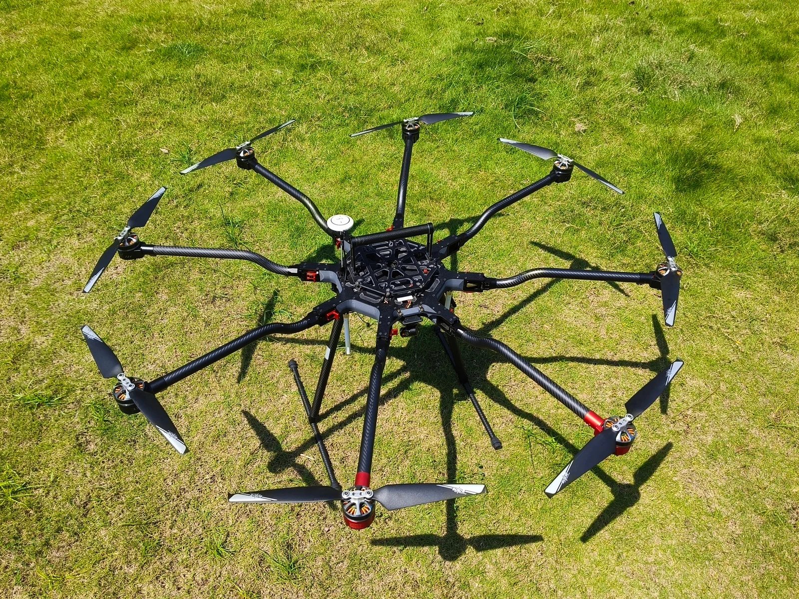
XJ-8A Multi-Mission UAV — For Tower and Close-Range Inspection
The XJ-8A Multi-Mission UAV is an eight-rotor aircraft designed for professional inspection, aerial imaging, mapping, and industrial monitoring.
Its maximum payload capacity of 5 kg and flexible sensor integration options make it suitable for inspection configurations requiring stabilized imaging equipment.
Key considerations:
- Eight-rotor platform for stable hovering
- Maximum payload capacity: 5 kg
- GPS and BeiDou positioning
- Compatible payload options including RGB, infrared, and multi-sensor systems
- Suitable for tower inspection and selected electrical infrastructure monitoring
The XJ-8A is a practical option when payload flexibility and precise positioning are important.
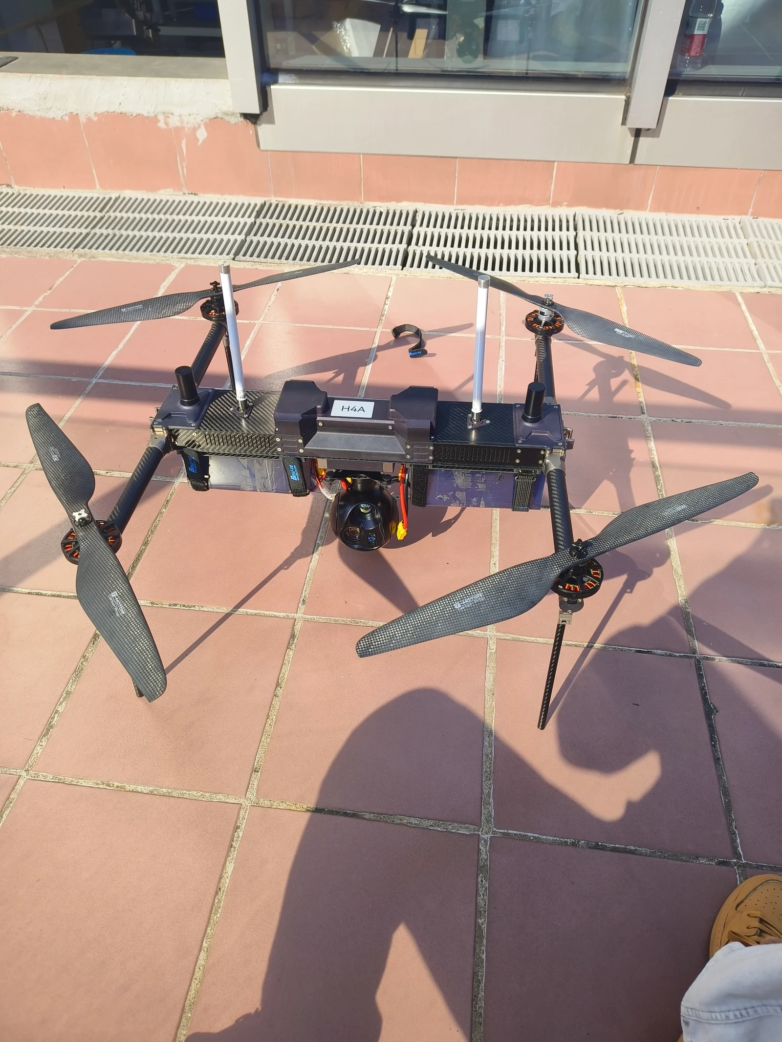
XJ-H4A Long-Endurance UAV — For Extended Multi-Rotor Missions
The XJ-H4A Long-Endurance UAV is designed for inspection missions requiring longer flight duration while retaining multi-rotor maneuverability.
It can be considered for repeated inspection routes and infrastructure monitoring where hovering remains necessary.
Key considerations:
- Long-endurance multi-rotor configuration
- Maximum payload capacity: 1.5 kg
- Flexible hovering and positioning
- Suitable for extended observation and inspection routes
The XJ-H4A is worth evaluating when inspection duration is important but a VTOL fixed-wing platform is not suitable for the required flight pattern.
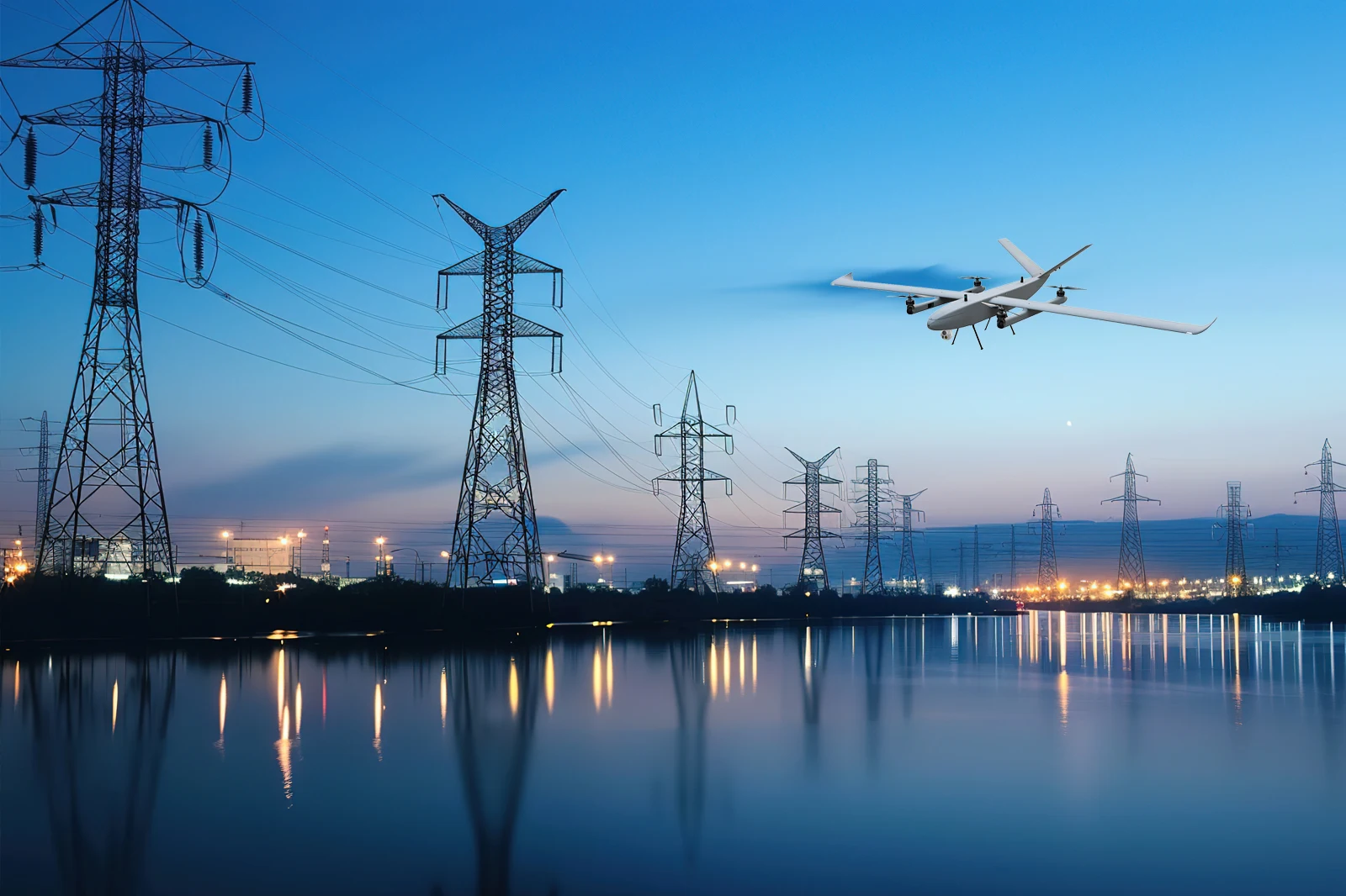
XJ-TR1 VTOL Fixed-Wing UAV — For Long-Distance Corridor Inspection
The XJ-TR1 VTOL Fixed-Wing UAV is designed for missions where efficient long-distance flight and wide-area coverage matter.
It combines vertical takeoff and landing with fixed-wing forward flight.
Key considerations:
- VTOL fixed-wing configuration
- Standard payload: 2 kg
- Maximum payload: 5 kg
- Suitable for extended utility corridors
- Supports wide-area mapping and aerial reconnaissance applications
The XJ-TR1 is particularly relevant for utility operators and inspection providers evaluating large transmission corridors or remote infrastructure projects.
Important: Payload compatibility, usable endurance, communications performance, and operating limits should be confirmed for each proposed configuration.
Explore the complete Inspection & Long-Endurance Drone Range.
7. How Does a Professional Drone Power Line Inspection Work?
A reliable inspection workflow includes more than selecting a drone and launching it near a transmission tower.
Step 1: Define the Inspection Scope
Identify the infrastructure to be inspected:
- Transmission towers
- Conductors
- Insulators
- Electrical fittings
- Substation equipment
- Utility corridors
Define the required inspection detail and expected deliverables.
Step 2: Select the UAV and Payload
Choose an aircraft according to coverage distance, terrain, payload requirements, and inspection objectives.
For close-range tower inspections, a multi-rotor UAV may be suitable.
For longer corridors, a VTOL aircraft may provide better route efficiency.
Step 3: Conduct Risk Assessment and Flight Planning
Review airspace requirements, power line clearances, electromagnetic interference, terrain, weather, and communication coverage.
Operators must establish appropriate stand-off distances and emergency procedures before flight.
Step 4: Collect Inspection Data
Use planned routes and suitable camera settings to collect the required visual, thermal, or mapping information.
Maintain consistent data-capture procedures where repeat inspections are expected.
Step 5: Review and Organize Findings
Inspection imagery can be organized by tower number, corridor section, asset type, and observation.
Suspected defects should be reviewed by qualified personnel and verified when necessary.
Step 6: Plan Follow-Up Maintenance
Inspection results can support maintenance planning, further diagnostic work, and subsequent condition monitoring.
For more information about the application, explore our Power Line Inspection Solutions.
8. How to Choose a Power Line Inspection Drone Manufacturer
For utility companies, drone service providers, distributors, and system integrators, selecting the right UAV manufacturer is as important as choosing the aircraft.
Before requesting a quotation, consider the following requirements.
Aircraft Performance
Evaluate practical endurance, payload capacity, flight stability, and suitability for the operating environment.
Camera and Sensor Integration
Confirm compatibility with the required zoom, thermal, or other inspection payloads.
Flight Control and Communication
Review waypoint capabilities, positioning systems, communication links, and return-to-home functions.
Customization Capability
Determine whether the supplier can support mission-specific integration, mounting systems, or equipment configurations.
Technical Documentation
Request relevant specifications, operating instructions, and test information.
After-Sales Support
Evaluate spare parts, maintenance guidance, troubleshooting support, and training requirements.
Total Project Cost
Consider the complete inspection system, including the aircraft, sensors, batteries, controllers, accessories, software, and support.
The lowest aircraft quotation does not necessarily represent the lowest long-term operating cost.
9. Can Power Line Inspection Drones Be Customized?
Industrial inspection requirements vary significantly between projects.
A utility company inspecting mountain transmission corridors may require a different configuration from a service provider inspecting individual towers.
Depending on technical feasibility, customization requirements may include:
- RGB and thermal payload integration
- Stabilized zoom-camera systems
- Mission-specific sensor mounting
- Communication configurations
- Flight control and positioning requirements
- Ground-control system integration
- OEM branding and documentation
- Application-specific UAV configurations
AeroSightX supports standard UAV platforms and can evaluate OEM/ODM configurations based on project requirements.
Learn more about our UAV Customization Services.
10. Frequently Asked Questions About Power Line Inspection Drones
What is the best drone for power line inspection?
The best drone depends on the inspection target, required sensor, flight distance, and operating environment. Multi-rotor drones are well suited to detailed tower inspections, while VTOL UAVs may be better for extended transmission corridors.
Can drones inspect energized power lines?
Drones can be used for appropriately planned inspections of energized infrastructure, subject to applicable regulations, utility procedures, electrical clearances, and risk assessments. Operators must not assume that an ordinary UAV is safe to fly close to energized conductors.
Can thermal drones detect electrical faults?
Thermal imaging can help identify abnormal heating associated with certain electrical conditions. However, not all faults produce detectable temperature changes, and thermal observations require appropriate interpretation.
How far can a power line inspection drone fly?
Actual mission range depends on aircraft design, payload, batteries, communication equipment, terrain, weather, and aviation restrictions. Published communication range should not be confused with approved operating distance or usable inspection coverage.
Are VTOL drones better than multi-rotor drones for power line inspection?
VTOL drones are often suitable for longer corridors, while multi-rotor drones are generally better for missions requiring sustained hovering and precise positioning. The ideal choice depends on the project.
What information should I provide when requesting an inspection drone quotation?
Provide the inspection target, corridor length, operating terrain, required camera or sensor, expected flight duration, project location, and estimated purchase quantity.
Build the Right UAV System for Your Power Line Inspection Project
Power line inspection drones are becoming an important tool for collecting aerial infrastructure data, improving access to difficult locations, and supporting utility maintenance decisions.
However, successful UAV inspection depends on the complete system—including aircraft performance, payload configuration, flight planning, data quality, and safe operation.
Whether your project involves transmission towers, remote power lines, substations, or long utility corridors, selecting the right UAV platform begins with understanding the inspection mission.
AeroSightX offers multi-rotor, long-endurance, and VTOL UAV platforms for industrial inspection applications, with configuration options for different project requirements.
Looking for a power line inspection drone manufacturer or a customized industrial UAV solution?
Contact AeroSightX to Discuss Your Inspection Project →
Share your inspection target, route length, required payload, operating environment, and expected quantity. Our team can help evaluate a suitable UAV platform and configuration.